KML is not so commonly used by mapmakers and GIS programmers.ESRI'S shapefile on the other hand is most commonly adopted in the field of GIS and therefore in this tutorial i will show how to convert between the two.
It is important to convert a shapefile(shp) to KML especially when you want to put it as an overlay in Google earth(accepts only KML or KMZ).
In this tutorial i will be using QGIS version 2.8.
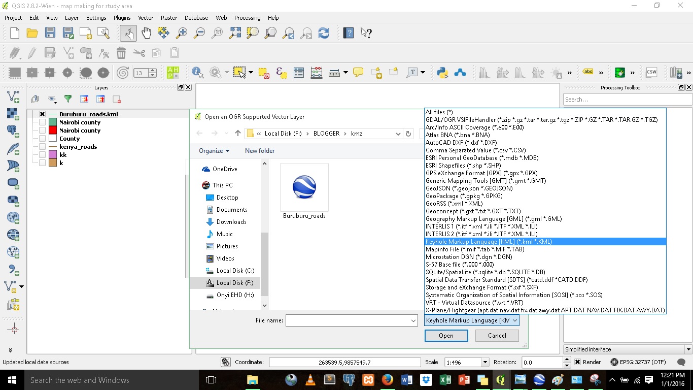
1.Select Layer in the menu bar and click 'Add vector Layer'.Browse to the KML file and in the 'source dataset type' select 'KML' or 'All files' and press open.

2.Right click on the added KML file on the side panel.Click on 'save as'.Select ESRI shapefile under the format ,give it an appropriate name and click save.

The same procedure is followed when converting SHP to KML,only that the format this time round is KML.
You can also check on my tutorial on;
Exporting KML in Google Earth
It is important to convert a shapefile(shp) to KML especially when you want to put it as an overlay in Google earth(accepts only KML or KMZ).
In this tutorial i will be using QGIS version 2.8.
1.Select Layer in the menu bar and click 'Add vector Layer'.Browse to the KML file and in the 'source dataset type' select 'KML' or 'All files' and press open.
2.Right click on the added KML file on the side panel.Click on 'save as'.Select ESRI shapefile under the format ,give it an appropriate name and click save.

The same procedure is followed when converting SHP to KML,only that the format this time round is KML.
You can also check on my tutorial on;
Exporting KML in Google Earth